The Weather Research Forecast (WRF) model is a next-generation limited-area numerical forecasting (LAM) system designed for the needs of research and operational forecasting of atmospheric phenomena. The WRF is a collaboration between the National Center for Atmospheric Research (NCAR)), the National Centers for Environmental Prediction (NCEP), and the National Oceanic and Atmospheric Administration (NOAA) Earth System Research Laboratory (ESRL). The structure of the model consists of a central core, called WRF Software Framework (WSF), composed of different assimilation and parameterization schemes of the physico-chemical variables, to which the pre and post processing modules are connected.
THE LOCAL AREA MODEL FOR SICILY
La configurazione della catena modellistica, frutto dell’esperienza pluriennale nel campo delle previsioni meteorologiche acquisita dal gruppo di ricerca, è specificamente ottimizzata per il territorio siciliano . Al fine di ottenere come output previsioni operative ad alta risoluzione sia spaziale che temporale, il suddetto sistema multi-model è stato ottimizzato mediante l’uso di dati orografici statici iniziali, di dati relativi al suolo e alla copertura vegetativa e di dati della temperatura del mare ad alta risoluzione.
The configuration of the modeling chain, the result of many years of experience in the field of weather forecasts acquired by the research group, is specifically optimized for the Sicilian territory. In order to obtain operational forecasts with high spatial and temporal resolution in output, the aforementioned multi-model system was optimized through the use of initial static orographic data, soil and vegetation cover data and high sea temperature data resolution.
Further developments concerned the study and optimization of the physical parameterizations used such as, for example, microphysics (parameterization inherent to the physical processes linked to the formation of hydrometeors, their growth and their fallout in the form of precipitation) and the parameterization of the schemes convective (which plays a fundamental role for a correct simulation of atmospheric dynamics as it is linked to the physical process of condensation and evaporation).
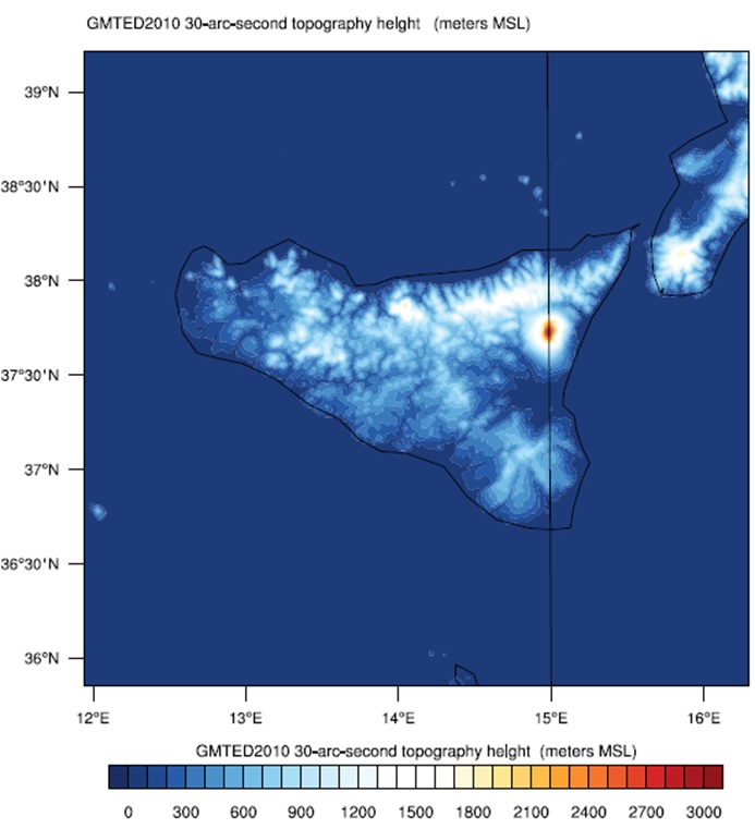
The model mentioned above allows to provide a detailed modeling of the orography of Sicily, characterized by a complex orography. In particular, through the nesting process, it is possible to progressively increase the spatial resolution of the model and therefore reproduce the orography of the territory with great precision, thus obtaining a spatial resolution of the grid of 1 km.
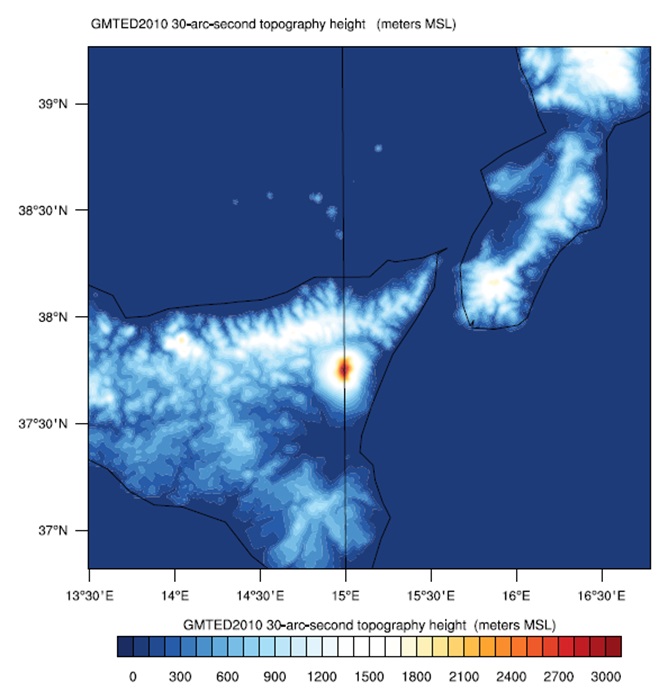
The model processes simulations with multiple daily runs, which allow it to produce very high resolution operational forecasts of up to 3 km of spatial detail. The table summarizes the characteristics of the various routes operating at the MIFT Department of the University of Messina:
| RUN TYPE | Spatial resolution | Duration | Temporal resolution | Initialization | Daily runs |
|---|---|---|---|---|---|
| WRF 3Km | 3 km | 72 h | 1 h | GFS 0.25° | 2(00,18z) |
Z = UTC (Universal Time Coordinated) is Greenwich meridian time: for local time add 1h in case of solar time or 2h in case of summer time.
Furthermore, on an experimental basis, simulations are carried out with a spatial resolution of the horizontal grid of 1km, on specific spots of particular interest.
All the variables necessary for the processing of a high spatio-temporal resolution weather forecast for 65 vertical levels are produced.